Worsley was first recorded in 1195 when records state that the land was given to Elias de Workesley on his return from the Crusades for his homage and service. The settlement of Workesley was named after him and the settlement went through around thirty different spellings until the mid-15th century when it became Worsley permanently.
The earliest visitors were the Romans who created a road linking Manchester to Wigan. The area was rural and dominated by agriculture until the 18th Century.
Since Medieval times seven halls have been built in the Worsley area, each one was designed in a completely different style and form.
Beesley Hall is a listed building located in Beesley Green to the north of Worsley village and to the west of Roe Green. It is now is divided into three homes and dates to at least the sixteenth century. It was named after the Beesley family who farmed the area.
Worsley Old Hall dates to the sixteenth century but has been much altered from the 19th century when it was used as offices for the Bridgewater estates and to its present use as a pub restaurant. Like Beesley Hall, it was originally constructed in timber and brick. It was a country seat of the Egerton family and the heart of the Worsley estate for centuries and is particularly important as it was where Francis Egerton, the 3rd Duke of Bridgewater along with James Brindley and John Gilbert planned the Bridgewater Canal, the canal that kick started the industrial revolution.
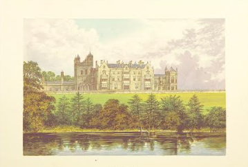
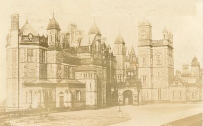
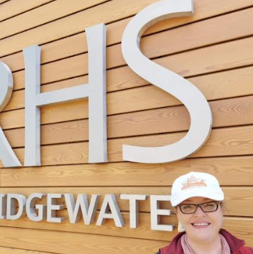
Worsley New Hall does not survive but is an important part of the Duke of Bridgewater’s estates as it is here where the Royal Horticultural Society decided to create its’ garden in the north-west of England, RHS Garden Bridgewater. This former mansion and gardens were located adjacent to a stretch of the Bridgewater Canal between the settlements of Worsley and Boothstown, with views towards Cheshire and North Wales.
This hall was completed for Lord Francis Egerton & his wife Lady Harriet 1846, with a grand design in the Elizabethan Gothic Style. It was designed by Edward Blore – who also designed the frontage at Buckingham Palace – indicating the wealth of the owner of the estate at that time.
Worsley New Hall was demolished between 1946-1949 and the materials were used to build houses in Yorkshire. The gardens were also grand designs. Designed by W.A. Nestfield, they included terraces, fountains, a croquet lawn and tennis courts as well as a boating lake and large kitchen gardens with ancillary buildings. Elements of these have been refurbished and are seen when visiting the RHS garden Bridgewater along with an award-winning modern building the size of a hall which houses the RHS visitor centre, shop, and café.
The history of these halls, their estate villages, important buildings, and people as well as the communities they created form part of the Worsley guided tours I offer.
This two hour guided walk takes you on a charming journey through the Eccles Town Trail, where blue plaques bring centuries of history to life. From sweet origins and global fame of the Eccles Cake to the remarkable tales behind the town’s most historic buildings, every stop reveals something new.
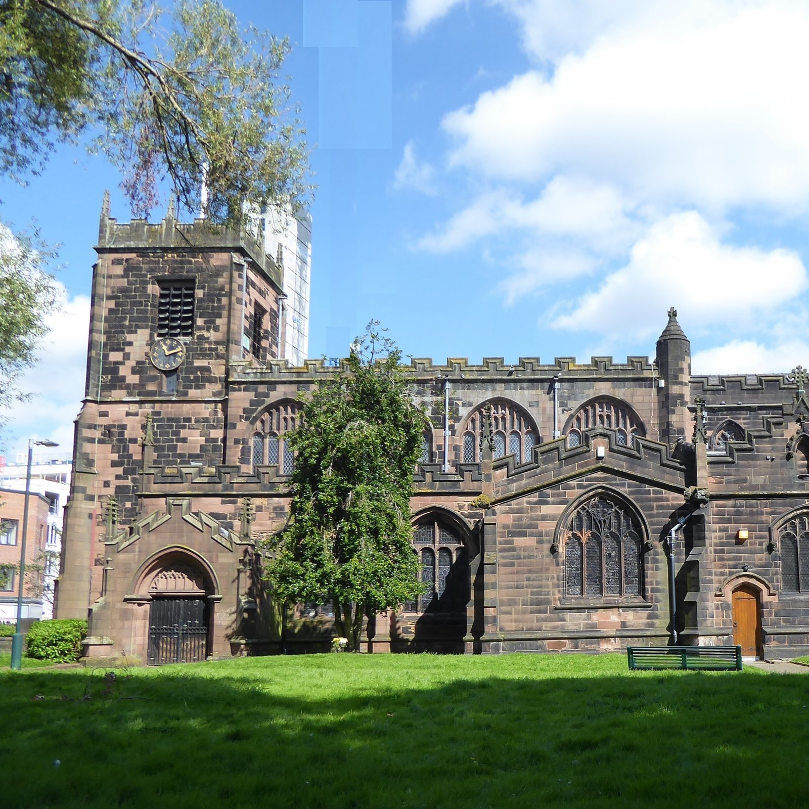
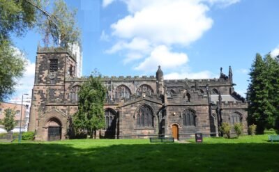
You’ll also enjoy a special visit inside St Mary’s Parish Church, the oldest building in Salford where heritage, architecture and tradition come together in one unforgettable setting.
Whether you’re a local wanting to rediscover your area or a visitor eager to explore, this tour offers a perfect blend of culture, curiosity and hidden gems.
Tour cost £10 including a donation to St Mary’s Parish Church
Start Time: 10:30
Thursday April 2nd 2026
Thursday July 2nd 2026
Thursday 1st October 2026
Note: Refreshments are not included in the tour price but available in the church at the end for a small donation.
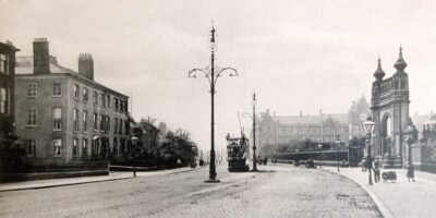
Wrench Postcard Series – Salford Crescent and Peel Park Entrance
Step into Salford’s rich and surprising heritage on this immersive 90 minute guided walk from Greengate— the city’s ancient heart—to the historic green oasis of Peel Park. Along the way, you’ll uncover more than simply buildings and landmarks: you’ll hear the stories, characters, and turning points that shaped Salford into the vibrant place it is today.
Your journey begins in Greengate, where Salford first took root. Among its medieval street patterns and industrial-era architecture, you’ll learn how the area grew from a small settlement on the River Irwell into a powerhouse of creativity, commerce, and change.
From there, we’ll follow a scenic route through the evolving cityscape, tracing the layers of history visible in mills, bridges, civic buildings, and regenerated waterfronts. Each stop reveals a new chapter—tales of invention, resilience, community, and transformation.
The walk culminates in the beautiful surroundings of Peel Park, one of the country’s earliest public parks and a beloved local landmark. Here, you’ll discover its Victorian origins, its role in Salford’s social history, and how it remains a treasured green space today.
This gentle, accessible walk is perfect for curious locals, history enthusiasts, and visitors alike. With engaging storytelling and plenty of fascinating stops, you’ll experience Salford as a living timeline—full of character, contrasts, and compelling stories waiting to be told.
Join Alexa Fairclough, Green Badge Bridgewater Canal tour guide and see Salford in a whole new light.
Tour Cost: £12
Date: Saturday 28th March 2026
Start Time: 10:30
Available Dates: Saturday 28th March 2026 and Saturday 3rd October 2026
You may well ask, ‘what is the connection between the Irwell and the Bridgewater Canal?’ There is one physical connection and plenty of indirect connections. One of the most indirect is that the original planned course for the Bridgewater Canal would have taken the canal from Monton to continue southeast to join the Irwell necessitating a transhipment across the river into Manchester. Instead, James Brindley, a consultant engineer on the canal’s construction advised a course that it takes today crossing the Manchester Ship Canal which at that time had been the Mersey & Irwell Navigation at Barton Aqueduct in 1761. This avoided the transhipment on the water of the Irwell.
The former Mersey & Irwell Navigation (M&IN) was created in the 1730s, well before the onset of the Bridgewater Canal which was connected to the Mersey at Runcorn in 1773 via a meandering contour route from Stretford that is roughly parallel to the Mersey & Irwell.
The course of the canal is in the Irwell River Catchment from Worsley to Manchester city centre and to Stretford, beyond which it enters the Mersey Catchment. It can be a tempestuous river as shown in 2015 when Storm Eva deposited 128mm in 36 hours on the Upper Irwell. Downstream, 750 houses were flooded in Salford and 670 in the Radcliffe/Redvales area. The river Irwell should be regarded as a major river but it isn’t because it is relatively short, only 39 miles from the source in the West Pennines above Bacup to the junction with the Mersey at Irlam.
In the early 70s there was a brief moment when the profile of the Irwell could have been improved as, in the wake of the 1972 Local Government Act, the new metropolitan borough of Salford was almost given the name Irwell but opposition pointed out that the Irwell flowed through two other boroughs and also didn’t flow through Worsley, even though Worsley Brook is a tributary of the Irwell.
There are claims that the river Mersey is a rarity among rivers in not being named after the larger tributary, i.e. the Irwell, rather than the smaller Mersey from the point at which they meet. The rivers met at Irlam and the confluence is now with the Manchester Ship Canal near Irlam Locks. The Mersey possibly also had the ascendancy in the name game because it was a boundary river between historic Lancashire and Cheshire and before that between the territories of Mercia to the south and Elmet to the north. So, whether or not it should have been ‘Ferry Across the Irwell’ is a moot point but shows that the Irwell is a historically under-rated river.
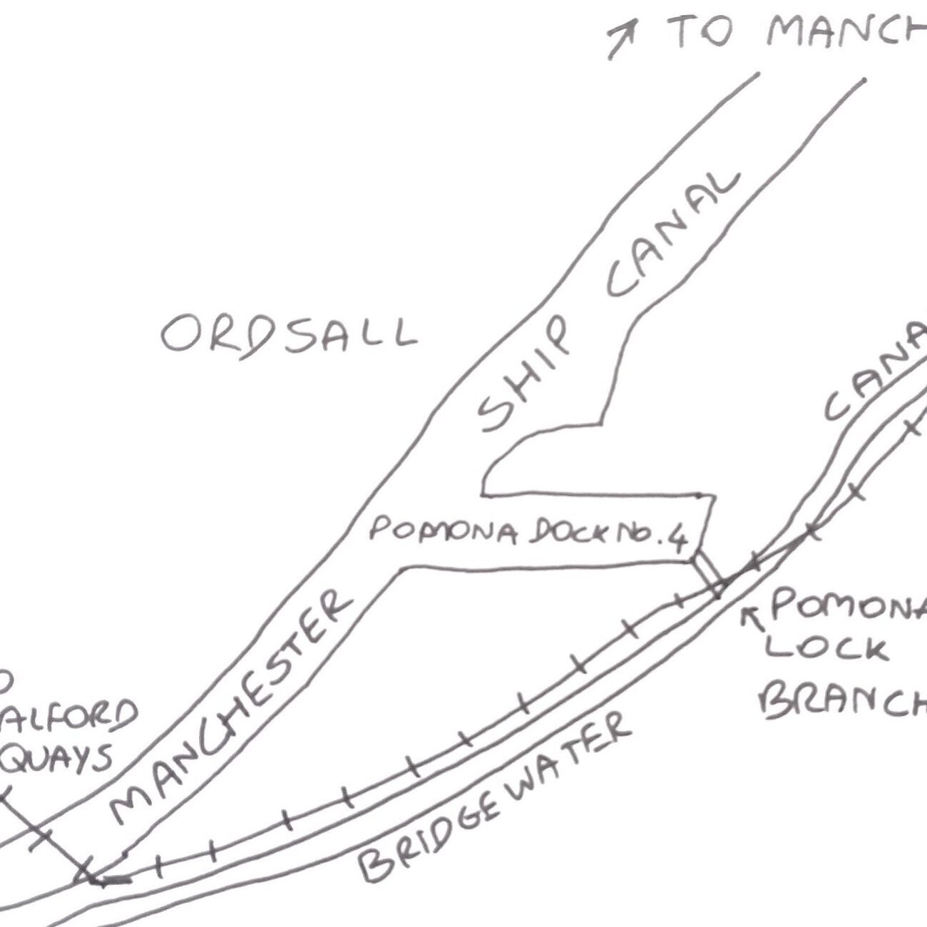
The Irwell should be regarded as a major river for its significant role in the development of the world’s first industrial revolution. And the conduit, so to speak, for that role has been two canals, the Bridgewater Canal and the Manchester Bolton & Bury Canal (MBBC). The relationship, the connection, between the three waterways is currently made on the 1.6km stretch of the Irwell between the Pomona Locks on the Bridgewater Canal and the Middlewood Locks on the MBBC.
The Pomona Lock Branch joins the Bridgewater Canal to the Ship Canal and river Irwell
The Bridgewater Canal joins the Ship Canal/Irwell at Pomona Lock (2009)
It is commonly accepted that the drivers for the world’s first industrial revolution were the features that came together in Manchester, namely coal, canals and cotton. Cotton was a consumer and industrial product and it was made affordable by the proximity of coal which was brought to market by the two canals. Thus, the mines at Worsley Delph and along the Irwell Valley gave up the coal that the two canals delivered; the Bridgewater to the wharfs at Castlefield and the MBBC to the wharfs at the aptly named Upper Wharf Street in Salford.
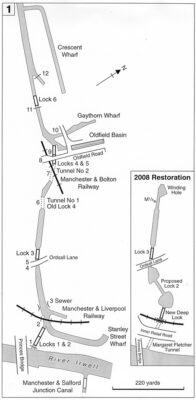
Of course, the Bridgewater Canal Company for many years did not want connections to be made for either the M&IN or the Johnny-come-lately of the MBBC which were both seen as a threat to its business ascendancy. The connection via Pomona docks was only made in 1995 and replaced the short Hulme Locks branch canal opened in 1839 to connect the Bridgewater Canal to the M&IN. In the same year, the MBBC finally made a connection via the river Irwell at Middlewood Locks to the wider network with the construction of the Manchester & Salford Junction Canal (M&SJC) which today can still be seen joining the Rochdale canal near the Rain! Bar in city centre Manchester. It is probably not a coincidence that the canals made the connections in the decade that launched the Railway era and consequent severe competition for the canals’ trade.
The Manchester Bolton & Bury Canal joins the river Irwell (map courtesy of the Manchester Bolton & Bury Canal Society – https://www.mbbcs.org.uk/ )
It is worth reflecting a little more on the intrinsic qualities of the river Irwell, regardless of its canal connections. Cyril Bracegirdle’s book “The Dark River – the Irwell” reflected in its title both its industrial heritage and pollution with 400 mills in proximity to the river found in a survey of 1800, and its propensity to flood.
Even in 1972, Bracegirdle records, the flow of water at the Adelphi Weir in Salford was 120 million gallons and that included 32 million gallons of outflow from seven sewage works and another 14 million gallons of industrial effluent from twenty-one factories. Today it is a much cleaner river with the totemic kingfishers seen regularly along the full length and in recent years the arrival of otters. In the late 19th century, Joseph Anthony wrote,
Whoe’er hath seen dark Irwell’s tide,
Its sombre look and sullen glide,
Would never deem that it, I ween,
Had ever brighter, gayer been
It’s not perfect now but it is certainly brighter than in those dark Irwell days and is overdue a recognition for its role in canal creation and the industrial revolution.
Manchester Bolton & Bury Canal joins the Irwell at Middlewood Locks (2024)
David Barnes Green Badge Tourist Guide for the Bridgewater Canal
If you are interested in visiting the Bridgewater Canal with a guide contact David on:
07961535163 / davidbarnes.david@gmail.com
Photo credits:
Manchester Bolton & Bury Canal joins the Irwell at Middlewood Locks – photo by David Barnes
Bridgewater Canal – joins the Ship Canal/Irwell via Pomona Lock – photo by David Barnes


