


Bollards!
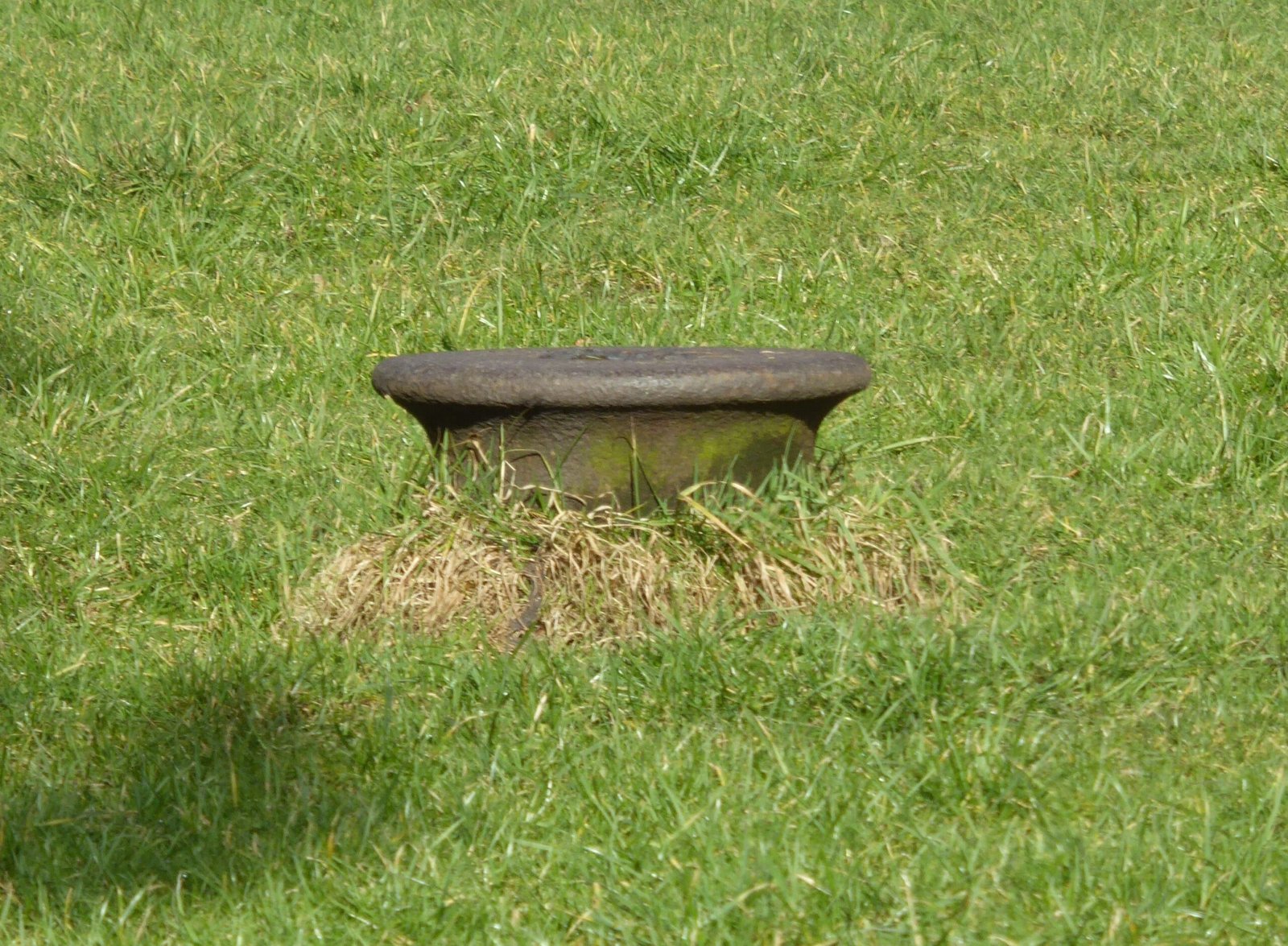
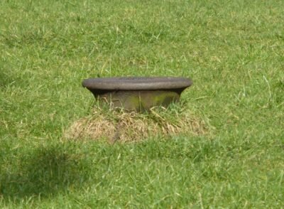
On Worsley Green there is an iron bollard sat on its own and looking very out of place.
Have you ever wondered why it is there?
What is a bollard?
A bollard is a sturdy, short, vertical post and originally described a post on a ship or wharf used principally for using ropes to secure boats.
The word is probably related to bole, referring to a tree trunk.
From the 17th and 18th centuries, old cannon were often buried muzzle first to be used as bollards on quaysides.
From the 19th century bollards were purpose-made, but often inherited a similar “cannon” shape.
What about our bollard?
Worsley Green used to be a busy industrial yard dating from the opening of the Bridgewater Canal in 1761. The yard built up around the Delph area to service the mines and canal at Worsley. It was not until the early 20th century that the yard was turned into the green that we know today. Our bollard is one of the last remnants of Worsley Yard.
Railways
An Ordnance Survey (OS) map from 1848 shows a mineral railway from Sanderson Pit (colliery), just east of Roe Green to the coal staithe on the canal at Worsley. At the time the coal wagons were moved by gravity and horses.
In 1864 the Eccles, Tyldesley & Wigan Railway opened which ran through Worsley Woods between Monton Green and Roe Green. It was connected to the mineral railway at Sanderson’s Siding. This led to the first steam locomotive being delivered to Worsley Yard in 1870 to replace horsepower and a branch line with an engine shed was built.
The OS map from around 1900 shows the area of the yard and the railway with location of new houses and green superimposed:
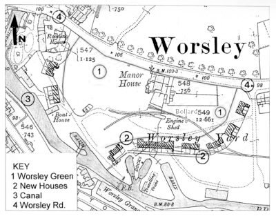
The bollard is opposite house No.146 and is shown on the map next to the railway that crossed the yard. It was close to the engine shed and was possibly used to tie up locomotive or wagons.
In 1905 the yard was cleared of almost all evidence of its industrial past and the houses we see today were built around what we now know as Worsley green. All that remains is the base of the yard chimney which became the Duke of Bridgewater memorial, the sluice for the culverted Worsley Brook, the ‘ghosts’ of the railway sleepers…And of course, our own ‘Worsley Yard Iron Bollard’ which is now over 150 years old and if sentient would have stories to tell.
Map of Worsley Green: From Ordnance Survey map survey of 1889, revised in 1904 and published 1908 (Image copied from Alan Godfrey Maps edition published 2003).
Thanks for additional detail of houses built around the Green and map provided by John Aldred.
Written by Mark Charnley, Bridgewater Canal Green Badge Guide.